Western Victoria Quarter Part 2: Cook Street and Motorway Severance
Victoria Quarter suffers for the Southern Motorway, and this alignment exists to serve the ego of Mayer John Allum:
This lack of foresight and common sense was compounded by Auckland city fathers led by former Mayor Sir John Allum, chairman of the bridge authority. He lobbied the National Roads Board to reconfigure State Highway 1 from its previous designated route around the city (ironically about where State Highway 20 is being retrofitted now at enormous cost) to a route directly through the centre of suburban and inner-city Auckland (causing great damage) and on to the bridge.
As former National Cabinet minister W.J. (Jack) Scott recalled in May 1999, State Highway 1 was moved because Sir John feared the toll revenue would be insufficient.
Sir John, he said, “had never been associated with a failure. No way was he going to run the bridge at a loss.” It was Jack Scott who pointed out that originally the southern and northwestern motorways were meant to be linked as ring road around the city - not slicing through it.
Michael Lee (Jun 1, 2009). Michael Lee: Sins of the fathers - legacy of harbour bridge.
Of course, anywhere the motorway went through would have the same fate - perhaps it is unfair to throw Westmere and Ponsonby under that particular bus.
At the 1953 mayoral election, Allum was defeated by J. H. Luxford who claimed the bridge would place untold costs on ratepayers for upgrading roads.
Indeed.
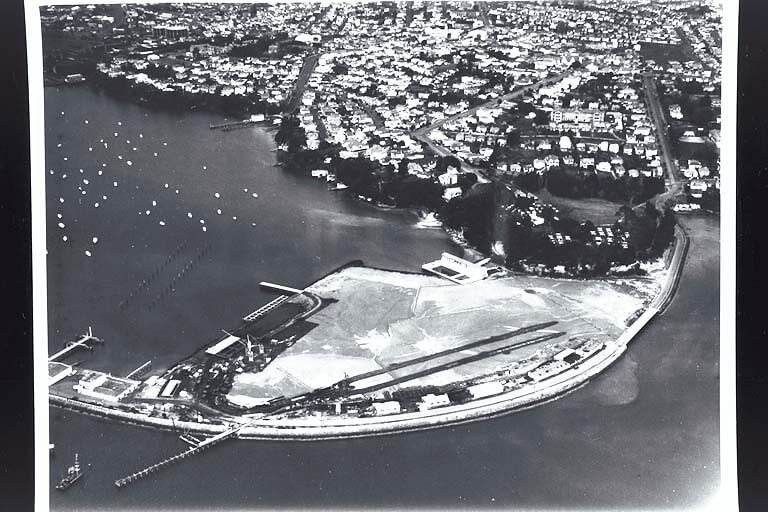 8 Aug 1955. Aerial view looking south east over Westhaven Boat Harbour showing preparations for the Auckland Harbour Bridge… 1955 (Sir George Grey Special Collections, Auckland Libraries, 459-19)
State Highway 1
So we got this:
 Aerial, 1968. Sir George Grey Special Collections, Auckland Libraries, NZ Map 7341
Beyond the removal of the northbound offramp into Franklin Road and the realignment of Union Street to make space for a carpark at the end of Sale Street, this is pretty much what we have today.
Ultimately, nothing can be done about the existence of motorway any time soon - everything is hung up in the AWHC:
- Previous plans to bury the entire Victoria Viaduct was prevented
- Route protection for a third decade ATAP project will restrict all change until I am an old man
The best case is the removal of the viaducts as part of a road AWHC crossing. In 30 years.
In the meantime, there is a surface level motorway passing through, with nothing to mitigate the noise or pollution it causes.
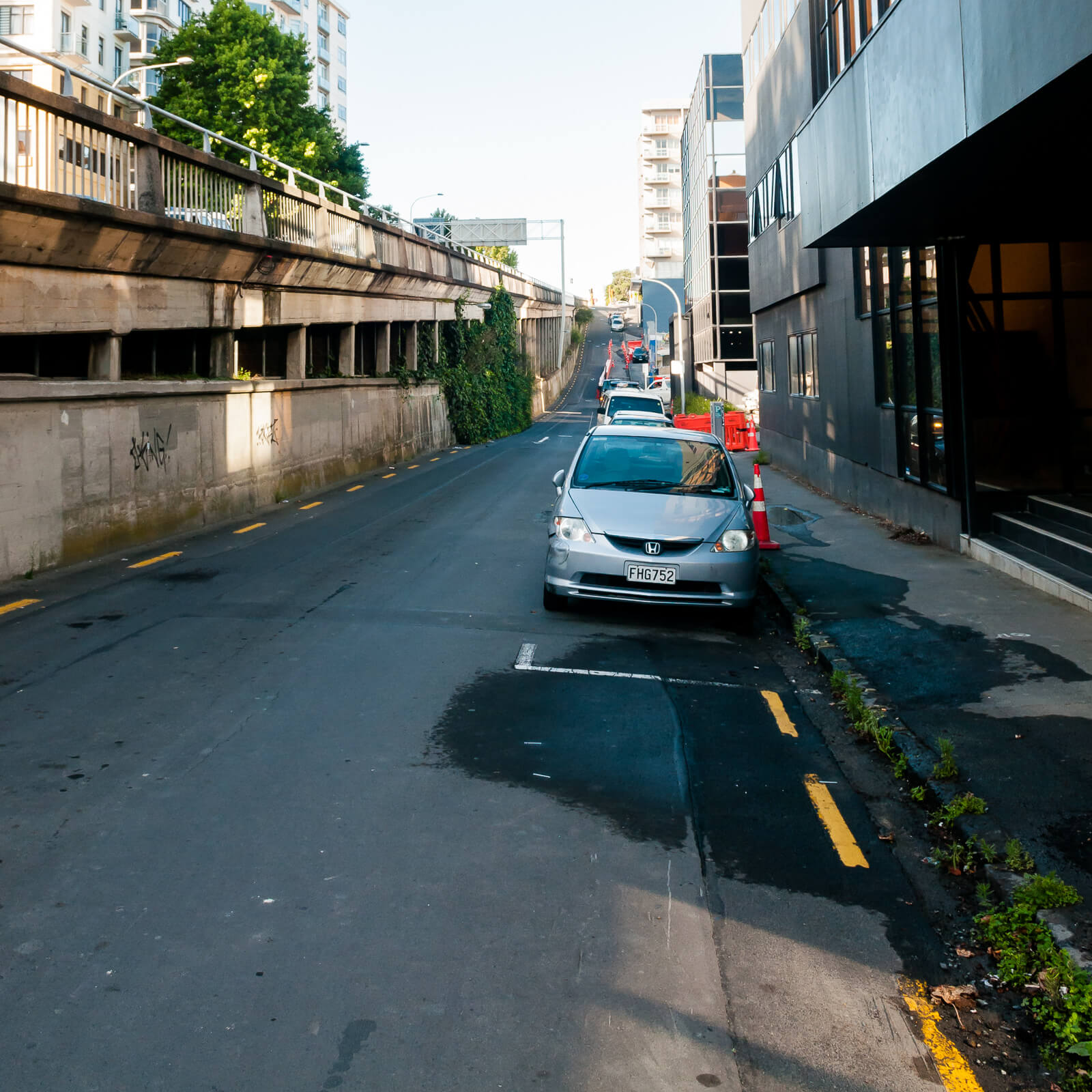
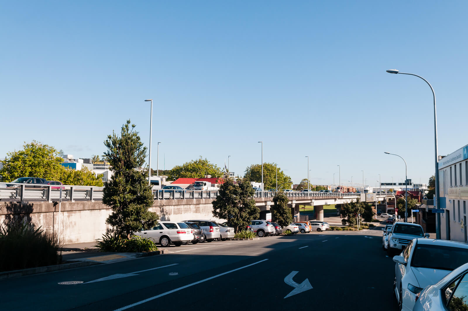 Union Street
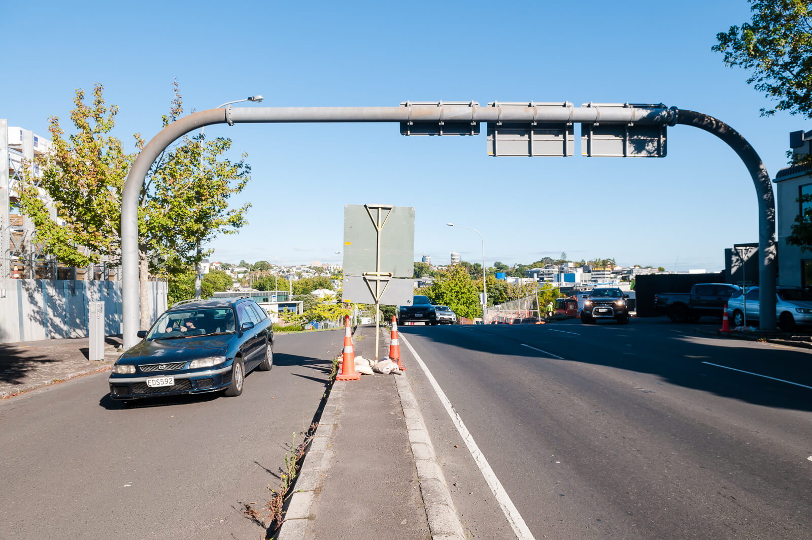
Cook Street
Conversely, I feel that Cook Street is something that can be changed today.
Why does anything need to be done? Because it is a canyon of disconnect, but it has potential:
It’s is the biggest obstacle to integrating Victoria Quarter with neighbouring communities, Freemans Bay (including Freemans Bay School and Auckland Girls Grammar), K’Rd, Eastern Ponsonby and Grey Lynn. The existence of this street in its current form fundamentally prevents movements between these areas. If you’ve ever tried to cross this street, you’d encounter something like this, on a route between Victoria Quarter and the nearest school
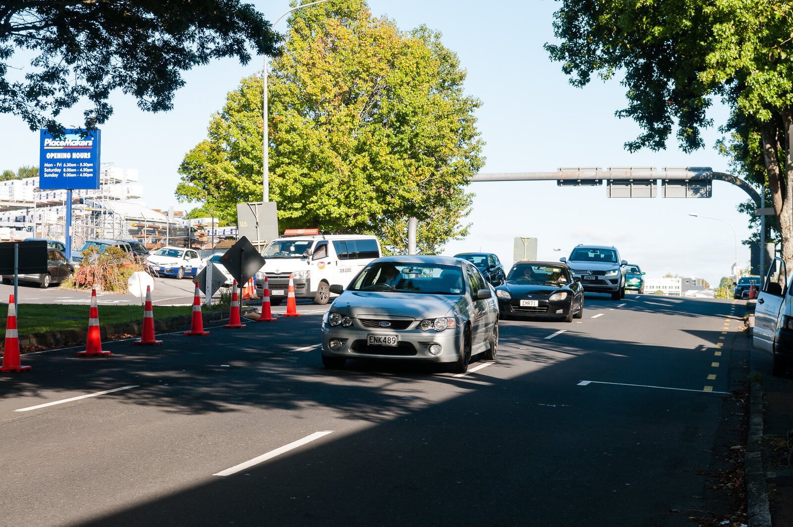
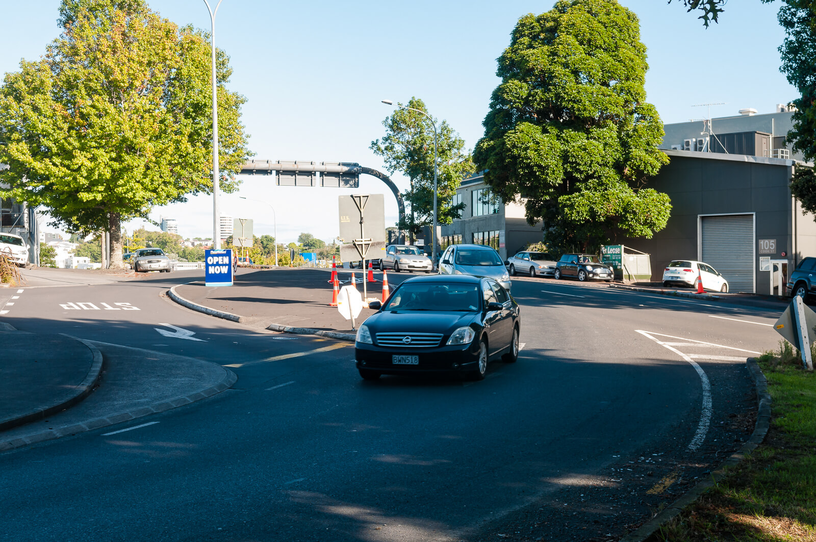
Here it is at the other end, narrowed down one lane each way, yet somehow still functioning:

It is, of course, possible to cross at any point. But due to the blind rise, the number of lanes (three, for a single lane offramp), the high speed of vehicles exiting the motorway, a lack of signalling and sudden lane changes, this is never safe and I’d wager impossible for children, the disabled, the elderly or anyone not willing to run across. There is an allocated crossing at the point with least visibility near Sam Wrigley Street, pictured below. Cars may park in the marked spaces at the bottom right of this image, directly in front of the crossing, further reducing visibility.

The kerbs here are, pointlessly, inaccessible to wheelchairs and an obstacle to prams, especially with cars bearing down well above the marked speed limit.
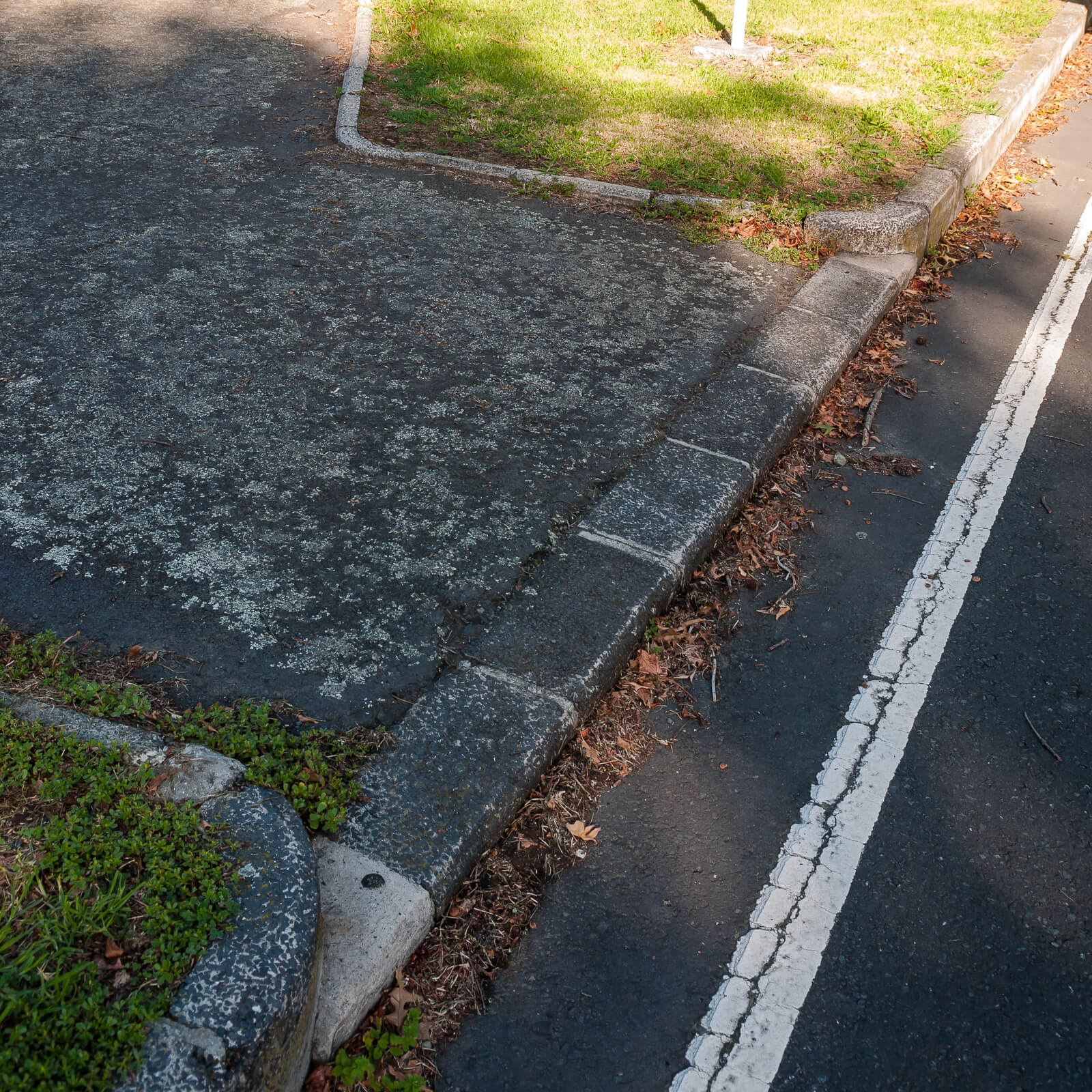
Once you’ve crossed onto the traffic island, further difficulties arise crossing North to Placemakers or the South to residential units. Going North, cars are turning at high speeds around the sweeping right turn, usually without indicating from a ‘straight+turn’ lane, over a blind rise. This traffic is then mixed in with traffic exiting from (and around) Placemakers that will be checking for speeding cars to their left, not pedestrians attempting to cross on their right.
(Oh whoops, make that four lanes)
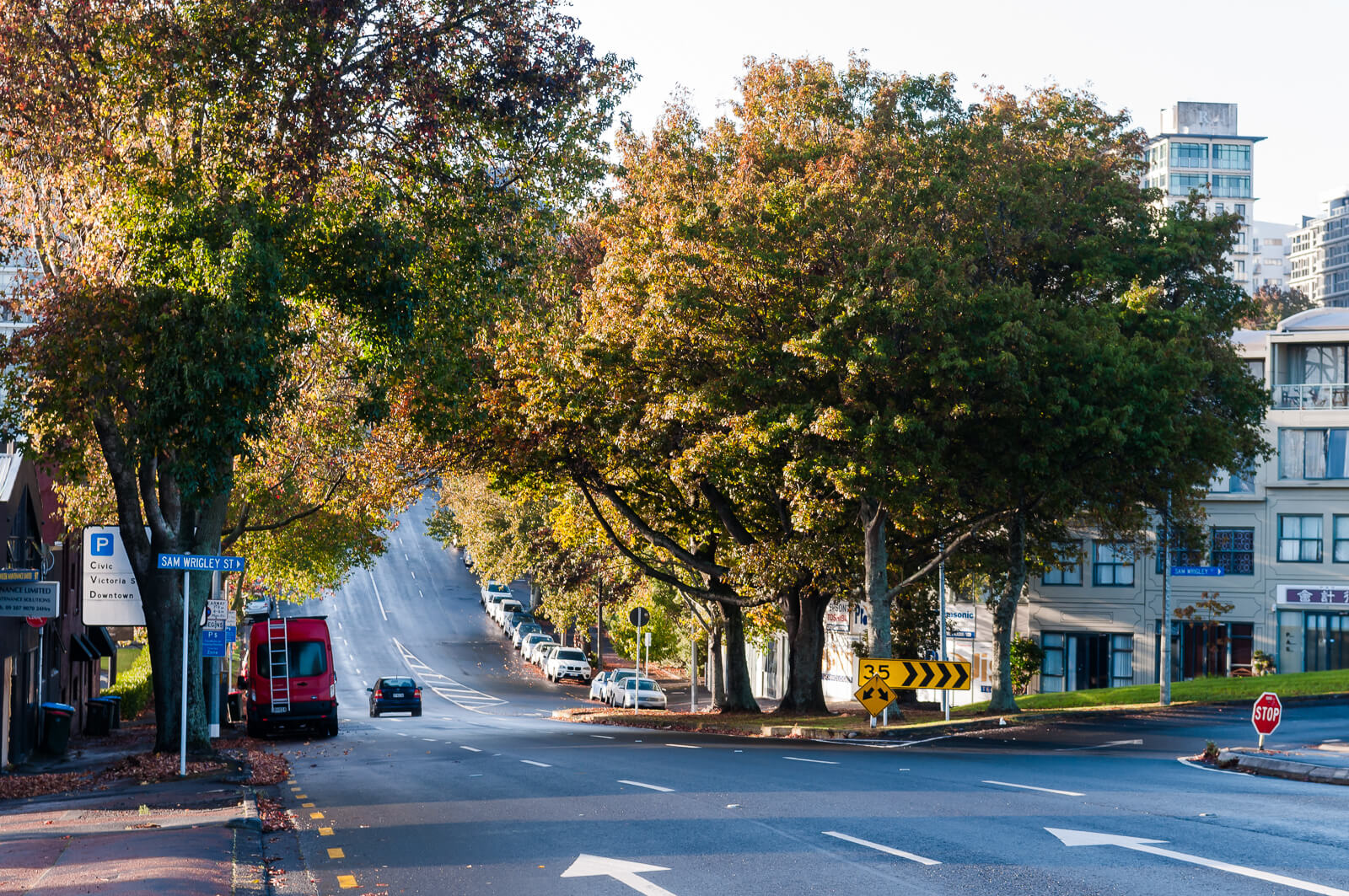
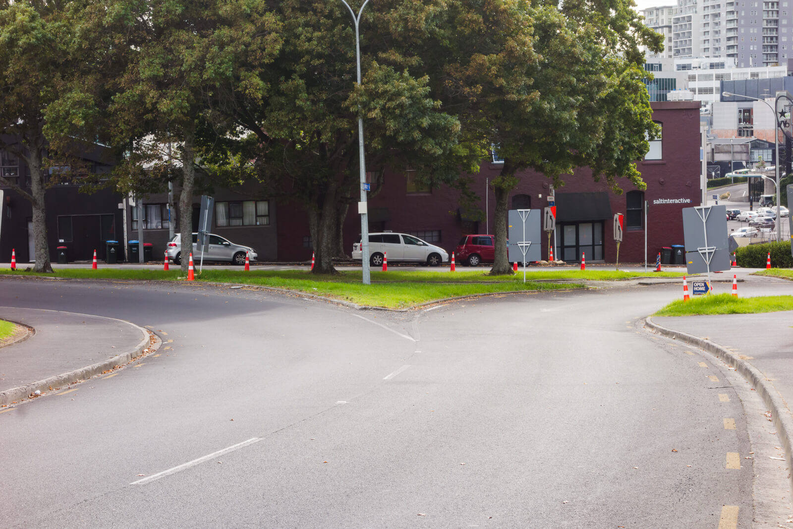
Sam Wrigley is made up of two sweeping turns merging into one. It is clear in the image below that the width of both roads is very wide and intended to allow cars to negotiate the corners at high speeds, with no consideration for pedestrian needs.
Stop getting in the way of cars, jerk!
To cross Cook Street at a safe, controlled intersection requires a detour of around 700m - 350m each way to Nelson Street and back, around 10 minutes. Or you could opt to head up Nelson Street, if that works for you, within this rather bleak streetscape. Many opt instead to use the separated Nelson Street bike lane.
The only proposed changes to Cook Street are related to the SH1 Additional Waitematā Harbour Crossing project, which ATAP has now aligned with the third decade, meaning 20-30 years of the status quo (Unless a future government rams it through regardless).
One of the proposed solution results in a tunnel portal which will be a blight on the area, along with the proposed roads not taking into account existing local building access on Cook Street. Nothing in this design considers the wider goals for the area, primarily focusing on ease of access to motor vehicles into the central city two decades from now, though it would at least permit safe crossing of Cook Street if the proposed link road between Sale and Union Streets has the radius tightened.
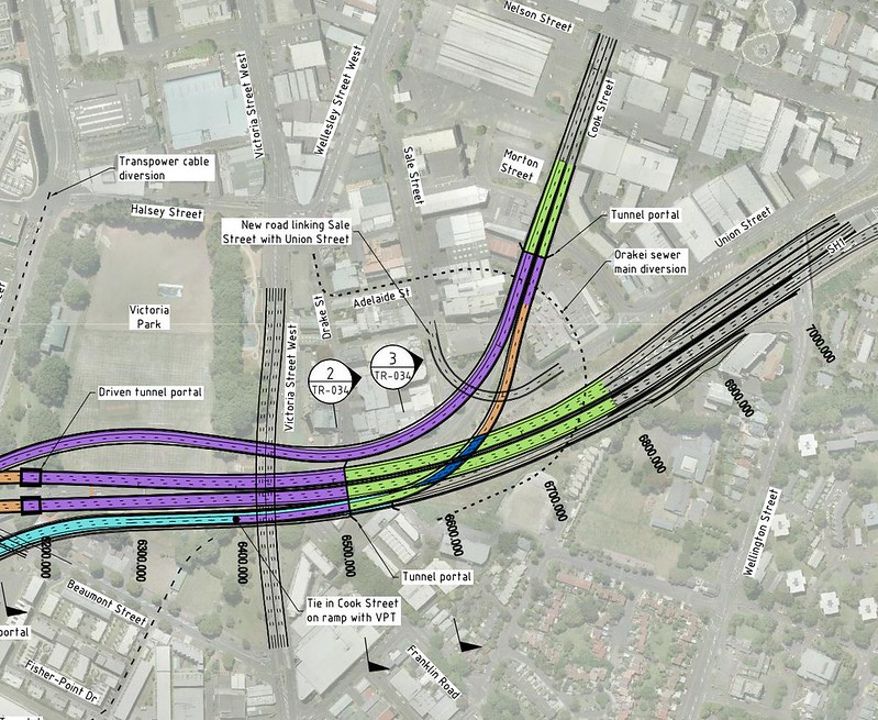 A potential outcome of AWHC project
The previously proposed realignment of the off-ramp up Union Street would have solved this issue (and by solved I mean made it someone else’s problem, though Grade separation of Union Street is much simpler than on Cook Street), but Auckland Council sold the Union Street car park to NZTA to use as the Central Incident Response Centre and it’s not clear who is really in charge of what happens in this area.
Who’s fault is this?
The current arrangement is here simply because no one ever changed anything. Cook Street has been this wide since its inception, with the same blind rise. There is no modelling that decided it needed to be this many lanes of traffic - when Cook street was turned into an offramp in the 60s, all that width was used solely because it existed - if one lane was enough, but there was space for more, then why not have as many as possible?
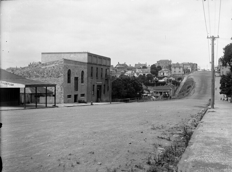 1928. Looking east along Cook Street from the vicinity of Morton Street towards Hobson Street (top right). (Sir George Grey Special Collections, Auckland Libraries, 4-2214)
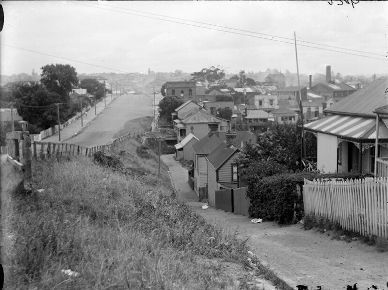 1928. Looking west from the vicinity of Nelson Street along Cook Street showing Morton Street (centre right). (Sir George Grey Special Collections, Auckland Libraries, 4-2216)
What to do?
In lieu of anything changing and the AWHC being decades away (assuming it brings with it any positive change), we need a solution to address the severance caused by Cook Street and the Motorway.
To address the motorway severance would require:
- Reconnecting Sale/Cook or Union to Freemans Bay School via bridge or massively improving pedestrian priority and amenity on the routes to and from the school and other areas
- Noise Barriers
- Placemaking on the periphery of the motorway to deal with the to the ‘industrial wasteland’ vibe
I can see three options for Cook Street, all of which I believe are required:
- Introduce speed reduction tools to slow Cook Street traffic
- Produce a safe, midblock crossing that aligns to pedestrian desire lines
- Grade separate the Cook Street off-ramp traffic from local traffic (with a potential realignment around placemakers site up Union, or just restricting to one, narrow, lane)
Most of this is already identified and discussed!! in the CCMP and District Plan. But where are the actual, tangible, timelined plans to do anything? How are brownfield sites ever going to compete with new suburbs if Auckland Council and Auckland Transport treat the non-vehicle users of these areas with such disdain?
Next time
Next time I’ll be covering vehicle priority and pedestrian design failures in area.